e99 Online Shopping Mall

Geometry.Net - the online learning center Help  
Home  - Basic W - Wisconsin Maps (Books)

  1-20 of 102 | Next 20
A  B  C  D  E  F  G  H  I  J  K  L  M  N  O  P  Q  R  S  T  U  V  W  X  Y  Z  

click price to see details     click image to enlarge     click link to go to the store

$5.49
1. Rand McNally Wisconsin Easyfinder
$4.95
2. American Map Wisconsin State Travel
$12.99
3. Lake Poygan & Winneconne Fishing
$29.23
4. Indian Names on Wisconsin's Map
$6.00
5. Cultural Map of Wisconsin: A Cartographic
$32.95
6. Family Maps of Dunn County, Wisconsin,
 
7. Rand McNally Wisconsin Easyfinder
 
8. The Atlas of Wisconsin: General
 
9. TEXACO ROAD MAP WISCONSIN 1932
$13.24
10. Report On the Lead and Zinc Deposits
$38.95
11. Family Maps of Dodge County, Wisconsin,
$4.99
12. Madison Wisconsin Street Map (American
$13.95
13. Backpacking Wisconsin
$22.68
14. Milwaukee WI Street Map
$4.60
15. Rand McNally Madison, Wisconsin
 
$10.99
16. Milwaukee, Wisconsin Regional
 
$30.56
17. Southern Wisconsin Area (Fishing
$38.95
18. Family Maps of Dane County, Wisconsin,
$0.15
19. National Geographic Wisconsin
$35.95
20. Family Maps of Iowa County, Wisconsin,

1. Rand McNally Wisconsin Easyfinder Map: Laminated
by Rand McNally and Company
Map: Pages (2003-08)
list price: US$7.95 -- used & new: US$5.49
(price subject to change: see help)
Asin: 0528994751
Canada | United Kingdom | Germany | France | Japan
Editorial Review

Product Description
The durable and convenient EasyFinderTM of Wisconsin will take all the wear and tear your journey can dish out. The laminated design allows you to mark your route, make notes, then wipe the surface clean for further use.

This map features enhanced cartography with: Clearly indicated highways,County Boundaries, Streets,Points of Interest and National Parks. ... Read more


2. American Map Wisconsin State Travel
Map: Pages (2007-02-15)
list price: US$4.95 -- used & new: US$4.95
(price subject to change: see help)
Asin: 0841691002
Canada | United Kingdom | Germany | France | Japan

3. Lake Poygan & Winneconne Fishing Map (Wisconsin Fishing Map Series, L243)
by Fishing Hot Spots
Map: Pages (2008)
-- used & new: US$12.99
(price subject to change: see help)
Asin: B002H5HMUW
Canada | United Kingdom | Germany | France | Japan
Editorial Review

Product Description
Waterproof lake fishing map, with lake-bottom contours, boat ramp locations, known fishing spots, and more. Lakes Butte des Morts, Poygan and Winneconne are known as the upriver lakes of the vast Winnebago system. Annual spring runs of walleye and white bass are famous and attract thousands of anglers yearly. Fishery boasts nearly 20 species of gamefish and panfish!. ... Read more


4. Indian Names on Wisconsin's Map
by Virgil J. Vogel
Paperback: 342 Pages (1992-02-15)
list price: US$24.95 -- used & new: US$29.23
(price subject to change: see help)
Asin: 0299129845
Canada | United Kingdom | Germany | France | Japan
Editorial Review

Product Description
Place names are cultural artifacts that tell us as much about how people lived as do relics dugs from the ground.They are historical records from which the location and migration of people, plants, and animals can be charted.Virgil Vogel's thirty years of research into Native American influence on geographical names has resulted in an absorbing account that illuminates the history and culture of Wisconsin Indians. ... Read more


5. Cultural Map of Wisconsin: A Cartographic Portrait of the State
by David Woodward, Robert C. Ostergren, Onno Brouwer, Steven D. Hoelscher, Joshua Hane
Map: Pages (1996-11-15)
list price: US$12.95 -- used & new: US$6.00
(price subject to change: see help)
Asin: 0299152448
Canada | United Kingdom | Germany | France | Japan
Editorial Review

Product Description
This extraordinary map, the first of its kind created for anystate, is a wonderful way to discover the history, culture, land, andpeople of Wisconsin. Nearly 1500 points of interest are located on themap, including the sites of Laura Ingalls Wilders Little House in theBig Woods near Pepin, the Worlds Largest Fish Fry at Port Washington,John Muirs boyhood farm near Montello, the Honor the Earth Pow Wow atLac Court Oreilles, the nations first kindergarten in Watertown, HoardsDairy Shrine in Fort Atkinson, the Pabst Mansion in Milwaukee, thegreat Peshtigo Fire, the Green Bay Packer Hall of Fame, and hundreds ofother fascinating places.The front of the map shows the entirestatetopography, roads, waterways, historic sites and historicalmarkers, archaeological areas, physical features and landscapes ofcultural significance, notable architecture, areas of ethnic andreligious importance, historic communities, festivals and fairs,lighthouses, museums and tours, colleges, parks and recreationaltrails, rustic roads, and places with celebrated literary, musical, andartistic connections. The back shows many more sites of interest onsmaller cultural maps of sixteen cities. All the maps incorporate ashaded relief background that displays Wisconsins rich variation inland forms, making it possible to see how local cultures areinextricably linked to regional landscapes. Six small thematic mapsemphasize this linkage and show historical changes in vegetation,population patterns, and local economies.

Inset Maps for 16 CitiesAppleton, Eau Claire, Fond du Lac, Green Bay, Janesville/Beloit,Kenosha/Racine, La Crosse, Madison, Manitowoc, Milwaukee countyincluding Waukesha, downtown Milwaukee, Oshkosh, Sheboygan, StevensPoint, Superior, Wausau

6 Theme Maps Native American Cultures fromPre-contact to the Present, Patterns of Euro-American Settlement,Regions of Euro-American Culture, Economic Regions, Physical Geographyand Glacial Processes, Vegetation in the 19th Century & late 20thCentury

Site Key Included with the map is a 16-page booklet with akey to the numbered symbols on the map. ... Read more


6. Family Maps of Dunn County, Wisconsin, Deluxe Edition
by Gregory A. Boyd
Paperback: 344 Pages (2010-07-16)
-- used & new: US$32.95
(price subject to change: see help)
Asin: 1420315420
Canada | United Kingdom | Germany | France | Japan
Editorial Review

Product Description
Locating original landowners in maps has never been an easy task--until now. This volume in the Family Maps series contains newly created maps of original landowners (patent maps) in what is now Dunn County, Wisconsin, gleaned from the indexes of the U.S. Bureau of Land Management. But it offers much more than that. For each township in the county, there are two additional maps accompanying the patent map: a road map and a map showing waterways, railroads, and both modern and many historical city-centers and cemeteries.

Included are indexes to help you locate what you are looking for, whether you know a person's name, a last name, a place-name, or a cemetery. The combination of maps and indexes are designed to aid researchers of American history or genealogy to explore frontier neighborhoods, examine family migrations, locate hard-to-find cemeteries and towns, as well as locate land based on legal descriptions found in old documents or deeds.

The patent-maps are essentially plat maps but instead of depicting owners for a particular year, these maps show original landowners, no matter when the transfer from the federal government was completed. Dates of patents typically begin near the time of statehood and run into the early 1900s.

This high-quality paperback book from the critically acclaimed Family Maps series measures 8-3/8" wide x 10-5/8" high. ... Read more


7. Rand McNally Wisconsin Easyfinder Map
by Rand McNally
 Paperback: Pages (1997-07)
list price: US$5.95
Isbn: 0528966901
Canada | United Kingdom | Germany | France | Japan

8. The Atlas of Wisconsin: General Maps and Gazetteer
by Arthur Howard Robinson
 Hardcover: 124 Pages (1974-10)
list price: US$27.50
Isbn: 0299065308
Canada | United Kingdom | Germany | France | Japan

9. TEXACO ROAD MAP WISCONSIN 1932
by Texaco
 Unknown Binding: Pages (1932)

Asin: B0042J9YWK
Canada | United Kingdom | Germany | France | Japan

10. Report On the Lead and Zinc Deposits of Wisconsin: With an Atlas of Detailed Maps
by Ulysses Sherman Grant
Paperback: 138 Pages (2010-01-09)
list price: US$20.75 -- used & new: US$13.24
(price subject to change: see help)
Asin: 1141299488
Canada | United Kingdom | Germany | France | Japan
Editorial Review

Product Description
This is a reproduction of a book published before 1923.This book may have occasional imperfections such as missing or blurred pages, poor pictures, errant marks, etc. that were either part of the original artifact, or were introduced by the scanning process.We believe this work is culturally important, and despite the imperfections, have elected to bring it back into print as part of our continuing commitment to the preservation of printed works worldwide.We appreciate your understanding of the imperfections in the preservation process, and hope you enjoy this valuable book. ... Read more


11. Family Maps of Dodge County, Wisconsin, Deluxe Edition
by Gregory A. Boyd
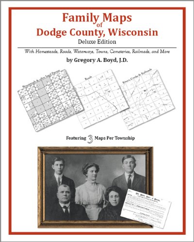
Paperback: 402 Pages (2010-07-16)
-- used & new: US$38.95
(price subject to change: see help)
Asin: 1420313649
Canada | United Kingdom | Germany | France | Japan
Editorial Review

Product Description
Locating original landowners in maps has never been an easy task--until now. This volume in the Family Maps series contains newly created maps of original landowners (patent maps) in what is now Dodge County, Wisconsin, gleaned from the indexes of the U.S. Bureau of Land Management. But it offers much more than that. For each township in the county, there are two additional maps accompanying the patent map: a road map and a map showing waterways, railroads, and both modern and many historical city-centers and cemeteries.

Included are indexes to help you locate what you are looking for, whether you know a person's name, a last name, a place-name, or a cemetery. The combination of maps and indexes are designed to aid researchers of American history or genealogy to explore frontier neighborhoods, examine family migrations, locate hard-to-find cemeteries and towns, as well as locate land based on legal descriptions found in old documents or deeds.

The patent-maps are essentially plat maps but instead of depicting owners for a particular year, these maps show original landowners, no matter when the transfer from the federal government was completed. Dates of patents typically begin near the time of statehood and run into the early 1900s.

This high-quality paperback book from the critically acclaimed Family Maps series measures 8-3/8" wide x 10-5/8" high. ... Read more


12. Madison Wisconsin Street Map (American Map)
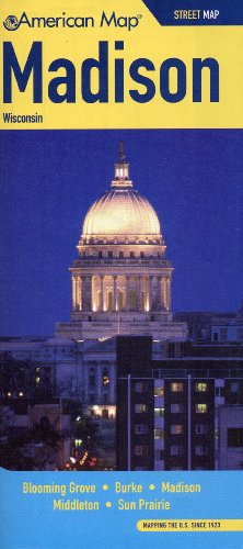
Map: Pages (2009-02)
list price: US$4.99 -- used & new: US$4.99
(price subject to change: see help)
Asin: 0841615357
Canada | United Kingdom | Germany | France | Japan

13. Backpacking Wisconsin
by Elizabeth D. Hailman, Jack P. Hailman
Paperback: 288 Pages (2000-09-25)
list price: US$19.95 -- used & new: US$13.95
(price subject to change: see help)
Asin: 029916814X
Average Customer Review: 4.0 out of 5 stars
Canada | United Kingdom | Germany | France | Japan
Editorial Review

Product Description
Wisconsin is a premier backpacking state, with outstanding opportunities for weekend trips. With its Great Lakes and river boundaries, national and state parks and forests, and stunning geological diversity, it offers a variety of experiences for both novice and experienced backpackers. In Backpacking Wisconsin Jack and Liz Hailman, drawing on years of personal experience, provide first-hand information for trails in every corner of the state-from the wooded Apostle Islands National Lakeshore, inhabited by whitetailed deer and black bears, to picturesque Newport State Park in Door County, set upon Silurian-age limestone laid down over 100 million years ago.

For each backpacking site you'll find:
*information on entrance fees and permits, campsites, & contact sources
*directions to the location
*detailed trail maps with keys that pinpoint roads, parking, trail shelters, water supplies, outhouses
*ratings for trails, scenery, quiet, solitude, and interest
*background information on history, geology, and terrain
*trail notes describing trees, shrubs, wildflowers, birds, and animals you may encounter.

Backpacking Wisconsin also provides an overview of the backpacking experience, tips for the beginner and the expert, hints on how to choose equipment (boots, packs, tents, sleeping bags, rain gear, stoves), notes on troublesome plants and animals, a list of state areas that no longer offer backpacking, schedules of fees, a checklist for backpacks, and a list of trail, outdoor, and conservation organizations. For those hesitant to venture deep into wilderness, the Hailmans spotlight "quasi-backpacking" sites. All you have to do is pick a trail!

"A user-friendly guidebook! I felt I was sitting at a kitchen table listening to the authors tell detailed stories of trips they have taken and offering advice on how I could share their experiences."-Greg Marr, editor of Silent Sports ... Read more

Customer Reviews (5)

4-0 out of 5 stars A good starting point
First off, I recommend reading other reviews as they have some good perspectives.

The book is set up into regions, which are mostly in the north with one region covering everything else including southern WI.As others mention the authors present a number of options in each region and go into depth in the form of narratives telling what their experiences on ones they have done.I enjoyed this as they kept it short, but these accounts probably provide certain information than other resources would so I don't think it's a bad thing to include.Still, as one reviewer mentioned, more practical information and less narrative might have been nice.But overall it gives you a good sense of places to go for ideas for trips, and what you might actually see there, and I think that's worth reading.

I too agree that their recommendation not to bring a cell phone is not a good piece of advice to follow.Always better to have it than not to have it.And they have some GPS advice suggesting that the devices are not all that helpful or accurate - from what I know the technology has improved since then and like cell phones, it's better to have than not, in most cases.

The book is also full of closeup maps, which are nice to have, but I know some are somewhat out-of-date now, so I wouldn't rely on them at all at this point except as a general tool for getting ideas.And there may be other information about the trails that is no longer accurate.So in short, pick this up as a starting point for ideas, but if you're actually going to do any of the trips in the book, check with whoever maintains the trail for updated information and maps.

5-0 out of 5 stars Really good, exactly the info I couldn't find anywhere else.
This is a great book.I am into backpacking but never recieved good info about it in our state (I choose to save it for vacations out west - not anymore).I really like how the authors put the book together with ratings of trails and persoanl experience. Excellenet organization. Unlike the other reviewer I think the personal accounts are much needed as they help describe exactly what it was like when the authors were there.This is exactly what Wisconsin backpackers need.I didn't want to make the mistake of going backpacking in Wisconsin and having it turn into something that was too civilized.This book describes what kinds of things are at the campsites or if campsites exist at all(then one must wilderness camp--my favorite).It acts as a guide as to which places will better suite your particular taste for backpacking so you aren't wasteing your whole summer trying to find good places to go.

1-0 out of 5 stars I wish I had bought a Falcon Guide
I do not like this book at all.Maybe it is because I am used to using Falcon Guides, but when I purchase a hiking or backpacking trail guide I expect good trail narratives, not a description of the author's hiking experience.I don't care what time they got into camp or what they had for dinner.In a backpacking book I expect some description of water availability from streams, lakes, etc.In this book the authors only describe whether or not public water is available at campsites.Since I have not found this book to be of much use in planning a backpacking trip to Wisconsin, I am now purchasing the Hiking Wisconsin Falcon Guide.

5-0 out of 5 stars Buy this book if your'e planning on backpacking in Wisconsin
This is a pretty darn good book. I live in Milwaukee and am pretty familiar with most of the places described. The info is accurate, and there's enough of it.A lot of good maps, too. The authors have divided the state into 5 backpacking regions and in each region they've listed many of the best backpacking parks and trails. It's satisfying to know that the authors have themselves backpacked most of the areas they describe. A lot of good stuff in this book, including general backpacking "how-to" info in the first part, but... There is one piece of advice that I think is poorly thought out. On page 25, their advice is to not bring a cell phone into the woods and that it is of little potential help. They talk of the subject in somewhat unrealistic terms, and only of getting lost in the woods and completely ignore other potential problems such as a medical emergency. As an experienced backpacker, I can tell you as they do... DON'T go into the woods if you aren't prepared for emergency and what to do if you get lost, but, if things do go bad and you have a cell phone with you (especially one of those really small, lightweight ones with a wide coverage area) you could be darn glad you brought it. Keep it turned off, use it only in emergencies and pray that it sends and receives OK from your location. This is the biggest potential problem with cell phones in an emergency, but coverage is getting better and technology is giving us more reliability. Their advice should have been (as it is in many other backpacking articles)...Bring a cell phone (with a fresh battery) if you want to, but understand that it is NOT guaranteed to work, keep it turned off except ONLY for emergencies and it is NO SUBSTITUTE for knowledge and smart preperation. Having said that (it's a small point that I made a big deal of)... DO buy this book if your'e looking at a backpacking trip in this wonderful state.

5-0 out of 5 stars Enthusiastically recommended for hikers & campers
Wonderfully illustrated throughout with maps and b/w photos, Backpacking Wisconsin is a comprehensive guide and informative overview to the best Wisconsin has to offer the outdoor enthusiast and hiker. For each recreational excursion surveyed the aspiring backpacker will find complete directions for getting there; information on entrance fees and permits, campsites, and contacts; detailed trail maps with keys to roads, parking, trail shelters, water supplies, and outhouses; ratings for trails, scenery, quiet, solitude, and points of interest; background information on history, geology, and terrain; trail notes describing trees, shrubs, wild flowers, birds, and mammals. Backpacking Wisconsin is an indispensable, success enhancing, outdoor recreation and travel guide. Enthusiastically recommended for hikers, campers, bird watchers, and nature lovers. ... Read more


14. Milwaukee WI Street Map
by American Map
Map: 1 Pages (2009-06-03)
list price: US$4.99 -- used & new: US$22.68
(price subject to change: see help)
Asin: 0841616620
Canada | United Kingdom | Germany | France | Japan

15. Rand McNally Madison, Wisconsin
by Rand McNally and Company
Map: Pages (2003-08)
list price: US$4.95 -- used & new: US$4.60
(price subject to change: see help)
Asin: 0528999826
Canada | United Kingdom | Germany | France | Japan
Editorial Review

Product Description
This detailed map of Madison, Wisconsin has complete coverage for the city and surrounding area, with an inset map for downtown, plus most major tourist and business districts. When you flip the map over, you will find a complete street index and a "city and vicinity" map of the entire metro area. ... Read more


16. Milwaukee, Wisconsin Regional (Thomas Guide and Street Guide Wall Map)
by Rand McNally
 Poster: Pages (2004-03)
list price: US$29.95 -- used & new: US$10.99
(price subject to change: see help)
Asin: 0528955691
Canada | United Kingdom | Germany | France | Japan

17. Southern Wisconsin Area (Fishing Maps from Sportsman's Connection)
by Sportsmans Connection
 Spiral-bound: Pages (2000-02)
list price: US$22.25 -- used & new: US$30.56
(price subject to change: see help)
Asin: 1885010257
Canada | United Kingdom | Germany | France | Japan

18. Family Maps of Dane County, Wisconsin, Deluxe Edition
by Gregory A. Boyd
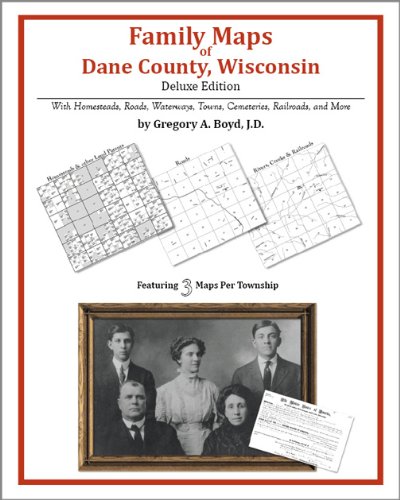
Paperback: 498 Pages (2010-07-16)
-- used & new: US$38.95
(price subject to change: see help)
Asin: 1420312162
Canada | United Kingdom | Germany | France | Japan
Editorial Review

Product Description
Locating original landowners in maps has never been an easy task--until now. This volume in the Family Maps series contains newly created maps of original landowners (patent maps) in what is now Dane County, Wisconsin, gleaned from the indexes of the U.S. Bureau of Land Management. But it offers much more than that. For each township in the county, there are two additional maps accompanying the patent map: a road map and a map showing waterways, railroads, and both modern and many historical city-centers and cemeteries.

Included are indexes to help you locate what you are looking for, whether you know a person's name, a last name, a place-name, or a cemetery. The combination of maps and indexes are designed to aid researchers of American history or genealogy to explore frontier neighborhoods, examine family migrations, locate hard-to-find cemeteries and towns, as well as locate land based on legal descriptions found in old documents or deeds.

The patent-maps are essentially plat maps but instead of depicting owners for a particular year, these maps show original landowners, no matter when the transfer from the federal government was completed. Dates of patents typically begin near the time of statehood and run into the early 1900s.

This high-quality paperback book from the critically acclaimed Family Maps series measures 8-3/8" wide x 10-5/8" high. ... Read more


19. National Geographic Wisconsin (Guidemaps)
by National Geographic Society, Rand McNally
Map: 1 Pages (1998-09)
list price: US$6.99 -- used & new: US$0.15
(price subject to change: see help)
Asin: 1572624124
Average Customer Review: 3.0 out of 5 stars
Canada | United Kingdom | Germany | France | Japan
Editorial Review

Product Description
############################################################################################################################################################################################################################################################### ... Read more

Customer Reviews (1)

3-0 out of 5 stars california map
This map is ok if you need the lamination; however, it doesn't have as much detail as a regular Rand McNally map, so be forewarned.It's alright if you're not going anywhere tricky or improvising a lot on the fly. ... Read more


20. Family Maps of Iowa County, Wisconsin, Deluxe Edition
by Gregory A. Boyd
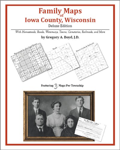
Paperback: 370 Pages (2010-07-16)
-- used & new: US$35.95
(price subject to change: see help)
Asin: 1420312839
Canada | United Kingdom | Germany | France | Japan
Editorial Review

Product Description
Locating original landowners in maps has never been an easy task--until now. This volume in the Family Maps series contains newly created maps of original landowners (patent maps) in what is now Iowa County, Wisconsin, gleaned from the indexes of the U.S. Bureau of Land Management. But it offers much more than that. For each township in the county, there are two additional maps accompanying the patent map: a road map and a map showing waterways, railroads, and both modern and many historical city-centers and cemeteries.

Included are indexes to help you locate what you are looking for, whether you know a person's name, a last name, a place-name, or a cemetery. The combination of maps and indexes are designed to aid researchers of American history or genealogy to explore frontier neighborhoods, examine family migrations, locate hard-to-find cemeteries and towns, as well as locate land based on legal descriptions found in old documents or deeds.

The patent-maps are essentially plat maps but instead of depicting owners for a particular year, these maps show original landowners, no matter when the transfer from the federal government was completed. Dates of patents typically begin near the time of statehood and run into the early 1900s.

This high-quality paperback book from the critically acclaimed Family Maps series measures 8-3/8" wide x 10-5/8" high. ... Read more


  1-20 of 102 | Next 20
A  B  C  D  E  F  G  H  I  J  K  L  M  N  O  P  Q  R  S  T  U  V  W  X  Y  Z  

Prices listed on this site are subject to change without notice.
Questions on ordering or shipping? click here for help.

site stats