|
|
Help |
| Home - Basic T - Texas Maps (Books) | |
e99 Online Shopping Mall
|
|
Help |
| Home - Basic T - Texas Maps (Books) | |
| 1-20 of 119 | Next 20 |
click price to see details click image to enlarge click link to go to the store
| 1. Maps of Texas and the Southwest, 1513-1900 (Repr of 1984 ed) (Fred H. and Ella Mae Moore Texas History Reprint Series, No 18) by James Martin, Robert S. Martin | |
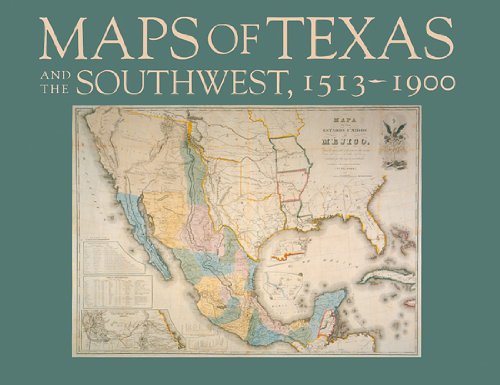 | Hardcover: 184
Pages
(1999-05-01)
list price: US$39.95 -- used & new: US$185.38 (price subject to change: see help) Asin: 087611169X Average Customer Review: Canada | United Kingdom | Germany | France | Japan |
Customer Reviews (2)
| |
| 2. American Map Texas: State Map | |
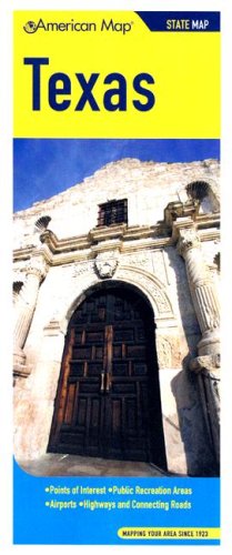 | Map:
Pages
(2008-04-02)
list price: US$4.95 -- used & new: US$4.95 (price subject to change: see help) Asin: 0841603286 Canada | United Kingdom | Germany | France | Japan |
| 3. Streetwise Austin Map - Laminated City Center Street Map of Austin, Texas (Streetwise (Streetwise Maps)) by Streetwise Maps | |
 | Map: 1
Pages
(2010-05-01)
list price: US$6.95 -- used & new: US$6.52 (price subject to change: see help) Asin: 193125737X Average Customer Review: Canada | United Kingdom | Germany | France | Japan |
|
Editorial Review Product Description This map covers the following areas: Named after Stephen F. Austin, the father of Texas, this eclectic capital city combines down-home charm with buzzing activity. Also known as the live music capital of the world due to all the music festivals sponsored here, Austin is a happening hip town for visitors and natives alike. Be on top of the action with a STREETWISE® map of Austin. With it you’ll discover all the cultural sites, as well as Austin’s physical attractions, like the natural pool at Barton Springs, the rolling green of Zilker Park and the nightly flight of over a million bats from beneath Congress Av. Bridge (Q21 on the downtown inset map). The inset map of downtown Austin shows an orderly grid system, clearly highlighted with hotels, points of interest, parking lots, museums and state government sites. The Austin Area map will navigate you in and around the city to such places as Austin Bergstrom International Airport and the Colorado River bike trails. From Lake Austin to Lake Travis, the STREETWISE® map of Austin gets you going to explore areas outside the center city. Our pocket size map of Austin is also laminated for durability and accordion folding for effortless use. The STREETWISE® Austin map is one of many detailed and easy-to-read city street maps designed and published by STREETWISE®. Buy your STREETWISE® Austin map today and you too can navigate Austin, Texas like a native. For a larger selection of our detailed travel maps simply type STREETWISE MAPS into the search bar. Customer Reviews (5)
| |
| 4. Texas Geologic Highway Map (Pvp (Series), Vol. 354.) by American Association of Petroleum Geologists | |
 | Map: 1
Pages
(1973-04-15)
list price: US$12.00 -- used & new: US$12.00 (price subject to change: see help) Asin: 0791815714 Canada | United Kingdom | Germany | France | Japan |
|
Editorial Review Product Description American Association Of Petroleum Engineers (AAPG) Founded in 1917, we are the world's largest professional geological society, with over 30,000 members. We are a pillar of the world-wide scientific community. Our books foster scientific research, advance the science of geology and promote the most effective use of petroleum extraction & processing technology and practice. Some of the areas we publish in include: GIS | |
| 5. Streetwise Dallas Map - Laminated City Center Street Map of Dallas, Texas by Streetwise Maps | |
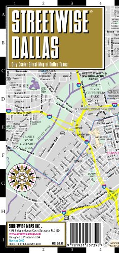 | Map:
Pages
(2010-01-01)
list price: US$6.95 -- used & new: US$5.59 (price subject to change: see help) Asin: 1931257396 Average Customer Review: Canada | United Kingdom | Germany | France | Japan |
|
Editorial Review Product Description This map covers the following areas: The big D radiates high society polish with Southwestern hospitality. Dallas is a city of contrasts, cosmopolitan and urbane, but also shows its individuality and the steadfast idealism of its Texas heritage. The STREETWISE® map of Dallas is much like the city. You can pull our boots on in the morning to survey the streets and sites of the city, and then appear in formal dress for dinner. And who says big city centers don’t change?! Dallas completely redeveloped the district around the American Airlines arena a few years ago. No longer just a city sporting hair that is dyed, fried and shoved to the side, Dallas is a sophisticated center of the southwest. OK, so you are only going to Dallas for a few days on business. The Downtown Dallas map is filled with important business information, like major corporate buildings, hotels, one way streets and a clear exit strategy to move uptown on McKinney Av past Crescent Court for cocktails and dinner. The main Dallas map contains the best graphic rendition of the Dallas Market District of any Dallas map ever made. The reverse side of the map also features a Dallas Area Map which is designed to help navigate in, out and around the Dallas metropolitan area. This is the Dallas map you’ll need when renting a car to travel to and from Dallas Fort Worth International Airport. Our pocket size map of Dallas is laminated for durability and accordion folding for effortless use. The STREETWISE® Dallas map is one of many detailed and easy-to-read city street maps designed and published by STREETWISE®. Buy your STREETWISE® Dallas map today and you too can navigate Dallas, Texas like a native. For a larger selection of our detailed travel maps simply type STREETWISE MAPS into the Amazon search bar. Customer Reviews (2)
| |
| 6. Texas State Wall Map - Laminated by National Geographic Maps | |
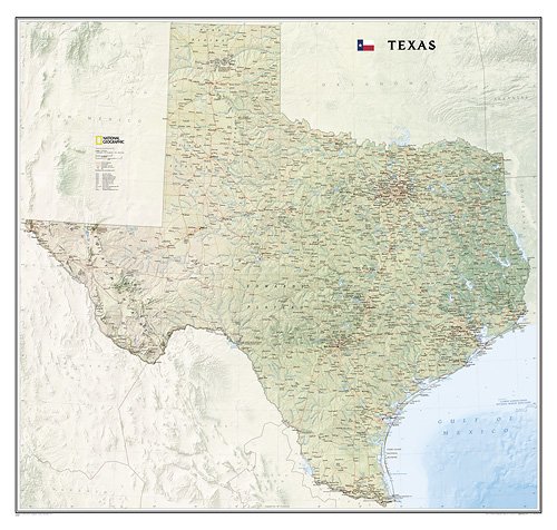 | Map:
Pages
(2009-07-01)
list price: US$39.99 -- used & new: US$26.39 (price subject to change: see help) Asin: 1597752444 Canada | United Kingdom | Germany | France | Japan |
|
Editorial Review Product Description | |
| 7. Backroads of Texas, 4th Edition: The sites, scenes, history, people, and places your map doesn't tell you about by Ed Syers | |
 | Paperback: 190
Pages
(2000-02-25)
list price: US$18.95 -- used & new: US$10.71 (price subject to change: see help) Asin: 089123053X Average Customer Review: Canada | United Kingdom | Germany | France | Japan |
|
Editorial Review Product Description Customer Reviews (3)
| |
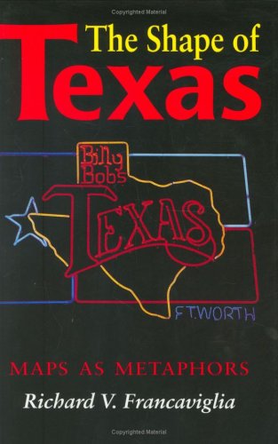
| 8. The Shape of Texas: Maps as Metaphors by Richard V. Francaviglia | |
 | Hardcover: 144
Pages
(1995-10-01)
list price: US$29.50 -- used & new: US$34.47 (price subject to change: see help) Asin: 0890966648 Average Customer Review: Canada | United Kingdom | Germany | France | Japan |
Customer Reviews (2)
Richard Francaviglia is an associate professorof history and the director of the Center for Greater Southwestern Studiesand the History of Cartography at the University of Texas at Arlington.Heis a talented writer, skilled at presenting abstract subjects so that theyare accessible to both his intellectual colleagues and to the intelligencelay reader.This book is evidence of that skill. As a northernertransplanted to Texas, Francaviglia has been struck by the overwhelmingpresence of the outline map of the state of Texas in advertising, companylogos, road signs, and other manifestations.As he notes in hisintroduction, "if Texas were a tribe located in an exotic part of theworld, anthropologists probably would have seriously studied their peculiaruse of the map by now.But as of this writing, no one else has describedthe phenomenon in this book." This is not an understatement.Ifthe reader doubts it when opening the book, he/she will not doubt it by theend.Francaviglia traces the rise of the use of the outline map in the20th century and its supplanting of the Lone Star as the most common Texasicon.He catalogues the use of the outline map in ways which span thegamut from the mundane to the bizarre.He does not, however, treat this asa source of humor (though many things are very funny), but rather assomething deeply revealing about Texas regional culture andcharacter. The book is well illustrated with 27 color plates and over 100black and white photos and drawings.It is a tribute to Dr. Francaviglia'sinterests in the topic that he obtained financing from the SummerleeFoundation of Dallas to enable the inclusion of the color plates whichwould not normally be possible in a book of this price and specializedinterest. If you have an academic interest in any of the topics I haveaddressed, this book is a must.If you are a Texan, this book is a hoot. If you are both, read and enjoy.You are guaranteed to both learn andlaugh out loud. ... Read more | |
| 9. Texas Wall Map (tubed) by National Geographic Maps | |
| Map:
Pages
(2009-01-01)
list price: US$24.99 -- used & new: US$24.99 (price subject to change: see help) Asin: 1597752436 Canada | United Kingdom | Germany | France | Japan |
|
Editorial Review Product Description | |
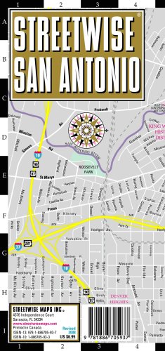
| 10. Streetwise San Antonio Map - Laminated City Center Street Map of San Antonio, Texas - Folding pocket size travel map by Streetwise Maps | |
 | Map: 1
Pages
(2008-12-27)
list price: US$6.95 -- used & new: US$4.94 (price subject to change: see help) Asin: 1886705933 Average Customer Review: Canada | United Kingdom | Germany | France | Japan |
|
Editorial Review Product Description This map covers the following areas: San Antonio is a town with a distinct Mexican flavor, rich in history and romance. From natural caverns to manmade missions, this Texas city is a crossroads where many cultures have mixed, mingled and merged. The STREETWISE® map of San Antonio showcases the central area of the city. The San Antonio Museum of Art (SAMA), the Jose Antonio Navarro State Historical Site and Market Square the largest Mexican marketplace outside of Mexico are all highlighted on the map. The Tower of the Americas is prominently illustrated along with the city’s trademarked section Riverwalk, a picturesque 2.5 mile cobblestone path that borders the San Antonio River. A detailed Riverwalk" inset map details the pedestrian path and features hotels, sites, and the convention center. The San Antonio Area map will navigate you in and around the region to places like San Antonio International Airport, Fort Sam Houston, McNay Art Museum, Sea World San Antonio, Six Flags Fiesta and to numerous missions like Mission Concepcion and Mission San Jose. There’s also Freeman Coliseum where the annual San Antonio Livestock Show and Rodeo is held each year. A complete index of streets, hotels, points of interest, shopping, education, culture, transportation and parks is clearly listed on the STREETWISE® San Antonio Map. Our pocket size map of San Antonio is laminated for durability and accordion folding for effortless use. The STREETWISE® San Antonio map is one of many detailed and easy-to-read city street maps designed and published by STREETWISE®. Buy your STREETWISE® San Antonio map today and you too can navigate San Antonio, Texas like a native. For a larger selection of our detailed travel maps simply type STREETWISE MAPS into the Amazon search bar. Customer Reviews (5)
One of the things I like best about them is that they clearly highlight museums, parks, and other tourist spots so that they are easy to find. The only drawback is that some of the text is mighty small, which can be a problem in low light if your eyes are over 40 like mine are. They are smaller than big fold-out paper maps, which is an advantage if, for safety reasons, you don't want to make it obvious that you are studying a map, advertising that you are a visitor. ... Read more | |
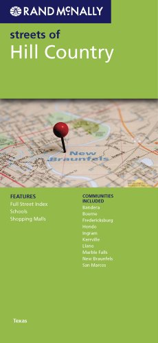
| 11. Rand Mcnally Streets of Hill Country Texas (Rand McNally Streets Of...) | |
 | Map:
Pages
(2010-01-05)
list price: US$5.99 -- used & new: US$5.51 (price subject to change: see help) Asin: 0528880926 Canada | United Kingdom | Germany | France | Japan |
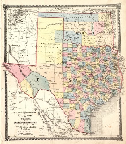
| 12. Reproduction Pre-Civil War 1860 Texas County map by S.A. Mitchell ~ 24" x 36" by Pete Charlton | |
 | Map:
Pages
(2004)
-- used & new: US$40.00 (price subject to change: see help) Asin: B002Z9RWLO Canada | United Kingdom | Germany | France | Japan |
|
Editorial Review Product Description | |
| 13. Maps of Texas, 1527-1900 | |
| Hardcover: 597
Pages
(1997-08-01)
list price: US$65.00 Isbn: 1578980542 Canada | United Kingdom | Germany | France | Japan | |
| 14. Rand Mcnally EasyFinder Texas by Rand McNally | |
 | Map:
Pages
(2005-10-24)
list price: US$7.95 -- used & new: US$5.88 (price subject to change: see help) Asin: 0528857800 Average Customer Review: Canada | United Kingdom | Germany | France | Japan |
Customer Reviews (1)
| |
| 15. On the underground position of the Ellenburger formation in north central Texas,: With a preliminary contour map, (University of Texas bulletin) by Elias Howard Sellards | |
| Paperback: 32
Pages
(1918)
Asin: B00086SIXW Canada | United Kingdom | Germany | France | Japan | |
| 16. Laminated South Central-USA4 Map by Borch (English Edition) (No. 4) by Borch | |
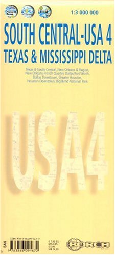 | Map: 2
Pages
(2006-12-01)
list price: US$9.95 -- used & new: US$4.98 (price subject to change: see help) Asin: 3866091672 Canada | United Kingdom | Germany | France | Japan |
|
Editorial Review Product Description | |
| 17. Atlas of Texas (Cultural and historical maps of Texas) by Stanley Alan Arbingast | |
| Paperback: 179
Pages
(1976-06)
list price: US$29.95 Isbn: 0877552614 Canada | United Kingdom | Germany | France | Japan | |
| 18. Streetwise Houston Map - Laminated City Center Street Map of Houston, Texas - Folding pocket size travel map with metro light rail by Streetwise Maps | |
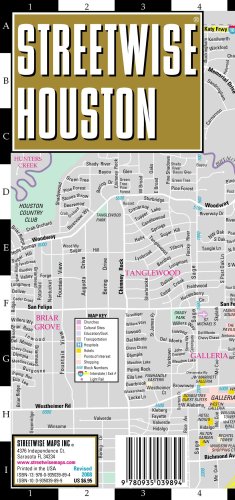 | Map: 1
Pages
(2007-12-27)
list price: US$6.95 -- used & new: US$3.03 (price subject to change: see help) Asin: 0935039899 Average Customer Review: Canada | United Kingdom | Germany | France | Japan |
|
Editorial Review Product Description This map covers the following areas: You probably didn’t know that Houston is the 4th largest city in America. The downside, its the leading city in metropolitan sprawl with high-rise towers and shopping malls spreading out forever over the low flat lands of Southeastern Texas. The upside, Houston has much to offer in terms of world class museums, fine dining, sports teams, parks and a hip party atmosphere. The STREETWISE® map of Houston is split north to south from front to backside and covers a large swatch of west Houston in detail. Districts like the Galleria are easy to find as well as places like Rice University, Hermann Park, and Reliant Stadium and of course downtown Houston. Downtown Houston, once the business core, is by day a bustling area filled with high-rise office buildings and hotels. To find your way you’ll need the STREETWISE® map of Houston with its inset of Downtown Houston. Without it you’ll easily get lost looking for the George R Brown Convention Center, Minute Maid Park, or the Toyota Center. There is nothing worse than driving around forever looking for something that is only minutes away. That won't happen provided you have the correct tool, like the STREETWISE® Houston Map. The Houston Area Map will help you navigate around outlying areas of the city and it will also help you locate Houston’s two airports: George Bush International and William P. Hobby Airport. Our pocket size map of Houston is laminated for durability and accordion folding for effortless use. The STREETWISE® Houston map is one of many detailed and easy-to-read city street maps designed and published by STREETWISE®. Buy your STREETWISE® Houston map today and you too can navigate Houston, Texas like a native. For a larger selection of our detailed travel maps simply type STREETWISE MAPS into the Amazon search bar. Customer Reviews (3)
| |
| 19. Reproduction 1872 Texas County Map by Warner & Beers~ 36" x 24" by Pete Charlton | |
 | Map:
Pages
(2006)
-- used & new: US$40.00 (price subject to change: see help) Asin: B002ZA2380 Canada | United Kingdom | Germany | France | Japan |
|
Editorial Review Product Description | |
| 20. Dallas (Popout Map) (Popout Map) by Compass Maps | |
 | Hardcover: 1
Pages
(2010-04-09)
list price: US$6.95 -- used & new: US$2.62 (price subject to change: see help) Asin: 1845876083 Canada | United Kingdom | Germany | France | Japan |
|
Editorial Review Product Description Dallas popout®map is a portable, comprehensive, and multipart map to the city. Complete with easy-to-read color maps, this pocket-size guide includes at-a-glance travel information about Dallas and its environs. The PopOut maps detail greater and downtown Dallas; three smaller maps provide overviews of neighboring Fort Worth, Irving, and Mesquite, as well as Fair Park. Details show places of interest, historic sites, shopping, parks, and more. | |
| 1-20 of 119 | Next 20 |