|
|
Help |
| Home - Basic R - Rhode Island Geography (Books) | |
e99 Online Shopping Mall
|
|
Help |
| Home - Basic R - Rhode Island Geography (Books) | |
| Back | 81-100 of 100 |
click price to see details click image to enlarge click link to go to the store
| 81. Rhode Island Route 77 | |
 | Paperback: 90
Pages
(2010-08-14)
list price: US$44.00 -- used & new: US$41.43 (price subject to change: see help) Asin: 6132266801 Canada | United Kingdom | Germany | France | Japan |
|
Editorial Review Product Description | |
| 82. Rhode Island Route 107 | |
 | Paperback: 134
Pages
(2010-08-12)
list price: US$58.00 -- used & new: US$57.99 (price subject to change: see help) Asin: 6132252894 Canada | United Kingdom | Germany | France | Japan |
|
Editorial Review Product Description | |
| 83. Rhode Island Route 3 | |
 | Paperback: 90
Pages
(2010-08-13)
list price: US$44.00 -- used & new: US$41.43 (price subject to change: see help) Asin: 6132265414 Canada | United Kingdom | Germany | France | Japan |
|
Editorial Review Product Description | |
| 84. Rhode Island Route 37 | |
 | Paperback: 90
Pages
(2010-08-13)
list price: US$44.00 -- used & new: US$41.43 (price subject to change: see help) Asin: 6132265740 Canada | United Kingdom | Germany | France | Japan |
|
Editorial Review Product Description | |
| 85. Rhode Island Route 177 | |
 | Paperback: 102
Pages
(2010-08-13)
list price: US$44.00 -- used & new: US$41.54 (price subject to change: see help) Asin: 613226468X Canada | United Kingdom | Germany | France | Japan |
|
Editorial Review Product Description | |
| 86. Rhode Island Route 138 | |
 | Paperback: 102
Pages
(2010-08-13)
list price: US$44.00 -- used & new: US$41.54 (price subject to change: see help) Asin: 6132264205 Canada | United Kingdom | Germany | France | Japan |
|
Editorial Review Product Description | |
| 87. Rhode Island Route 98 | |
 | Paperback: 90
Pages
(2010-08-14)
list price: US$44.00 -- used & new: US$41.43 (price subject to change: see help) Asin: 6132267042 Canada | United Kingdom | Germany | France | Japan |
|
Editorial Review Product Description | |
| 88. Southern New England: Connecticut, Massachusetts, Rhode Island (State Reports) by Thomas G. Aylesworth, Virginia L. Aylesworth | |
| Library Binding: 64
Pages
(1990-07)
list price: US$18.95 -- used & new: US$28.43 (price subject to change: see help) Asin: 0791010384 Canada | United Kingdom | Germany | France | Japan | |
|
Editorial Review Product Description | |
| 89. Cranston, Rhode Island | |
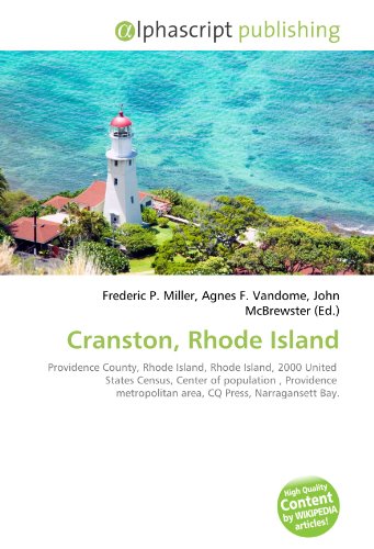 | Paperback: 128
Pages
(2010-08-10)
list price: US$60.00 -- used & new: US$59.99 (price subject to change: see help) Asin: 6130708254 Canada | United Kingdom | Germany | France | Japan |
|
Editorial Review Product Description | |
| 90. Rhode Island Route 136 | |
 | Paperback: 102
Pages
(2010-08-13)
list price: US$44.00 -- used & new: US$41.54 (price subject to change: see help) Asin: 6132264051 Canada | United Kingdom | Germany | France | Japan |
|
Editorial Review Product Description | |
| 91. Rhode Island Route 51 | |
 | Paperback: 90
Pages
(2010-08-14)
list price: US$44.00 -- used & new: US$41.43 (price subject to change: see help) Asin: 6132266585 Canada | United Kingdom | Germany | France | Japan |
|
Editorial Review Product Description | |
| 92. Rhode Island Route 152 | |
 | Paperback: 102
Pages
(2010-08-13)
list price: US$44.00 -- used & new: US$41.54 (price subject to change: see help) Asin: 6132264574 Canada | United Kingdom | Germany | France | Japan |
|
Editorial Review Product Description | |
| 93. Rhode Island Route 78 | |
 | Paperback: 90
Pages
(2010-08-14)
list price: US$44.00 -- used & new: US$41.43 (price subject to change: see help) Asin: 6132266836 Canada | United Kingdom | Germany | France | Japan |
|
Editorial Review Product Description | |
| 94. Rhode Island Route 116 | |
 | Paperback: 110
Pages
(2010-08-13)
list price: US$50.00 -- used & new: US$49.99 (price subject to change: see help) Asin: 6132263365 Canada | United Kingdom | Germany | France | Japan |
|
Editorial Review Product Description | |
| 95. Rhode Island Route 99 | |
 | Paperback: 90
Pages
(2010-08-14)
list price: US$44.00 -- used & new: US$41.43 (price subject to change: see help) Asin: 6132267069 Canada | United Kingdom | Germany | France | Japan |
|
Editorial Review Product Description | |
| 96. Rhode Island Route 402 | |
 | Paperback: 90
Pages
(2010-08-13)
list price: US$44.00 -- used & new: US$41.43 (price subject to change: see help) Asin: 613226602X Canada | United Kingdom | Germany | France | Japan |
|
Editorial Review Product Description | |
| 97. Rabbit Island (Rhode Island) by Lambert M. Surhone, Miriam T. Timpledon, Susan F. Marseken | |
 | Paperback: 104
Pages
(2010-06-25)
list price: US$48.00 -- used & new: US$48.00 (price subject to change: see help) Asin: 6130558767 Canada | United Kingdom | Germany | France | Japan |
|
Editorial Review Product Description | |
| 98. Rhode Island Route 216 | |
 | Paperback: 102
Pages
(2010-08-13)
list price: US$44.00 -- used & new: US$41.54 (price subject to change: see help) Asin: 6132264981 Canada | United Kingdom | Germany | France | Japan |
|
Editorial Review Product Description | |
| 99. Park Square, Rhode Island | |
| Paperback: 88
Pages
(2010-10-01)
list price: US$47.00 -- used & new: US$43.00 (price subject to change: see help) Asin: 6133200456 Canada | United Kingdom | Germany | France | Japan | |
|
Editorial Review Product Description | |
| 100. Rhode Island Route 91 | |
 | Paperback: 90
Pages
(2010-08-14)
list price: US$44.00 -- used & new: US$41.43 (price subject to change: see help) Asin: 6132266909 Canada | United Kingdom | Germany | France | Japan |
|
Editorial Review Product Description | |
| Back | 81-100 of 100 |